
Mining
At Geospatial Solutions, we specialize in utilizing GIS technology to support the mining industry. Our services include providing expert analysis and visualization of data related to resource exploration, management, and environmental impact. We assist mining companies in making informed decisions and minimizing the environmental impact of their operations. Contact us to learn how we can support your mining goals with data-driven insights and analysis.
One key advantage of using GIS in the mining industry is that it can help companies to identify and evaluate potential mining sites. By analyzing data such as geology, topography, and land ownership, GIS can help mining companies to identify areas that are likely to contain valuable minerals or other resources. GIS can also help to identify any potential risks or challenges associated with a particular site, such as environmental impacts or the need for expensive infrastructure. GIS can also be used to manage and monitor mining operations once they are underway. This can include tracking the location and production of different resources, monitoring the safety and health of workers, and identifying any environmental impacts. GIS can also be used to analyze the economic feasibility of different mining projects, helping companies to make informed decisions about which projects to pursue. Overall, GIS is a valuable tool for the mining industry, helping companies to identify and evaluate potential mining sites, manage and monitor operations, and make informed decisions about which projects to pursue. By using GIS to analyze and visualize spatial data, mining companies can make more informed and strategic decisions that can help to ensure the success of their operations.
WHAT ARE THE ADVANTAGES?
Resource management: GIS can be used to manage and track the location and availability of resources, such as minerals and materials. This can help to optimize the use of resources and reduce waste.
Environmental monitoring: GIS can be used to monitor and track the environmental impacts of mining operations, such as water quality, air quality, and wildlife habitats. This can help to identify and mitigate potential environmental risks.
Safety: GIS can be used to track and monitor safety incidents and hazards in the mining industry, such as accidents, injuries, and environmental risks. This can help to improve safety and reduce the risk of accidents.
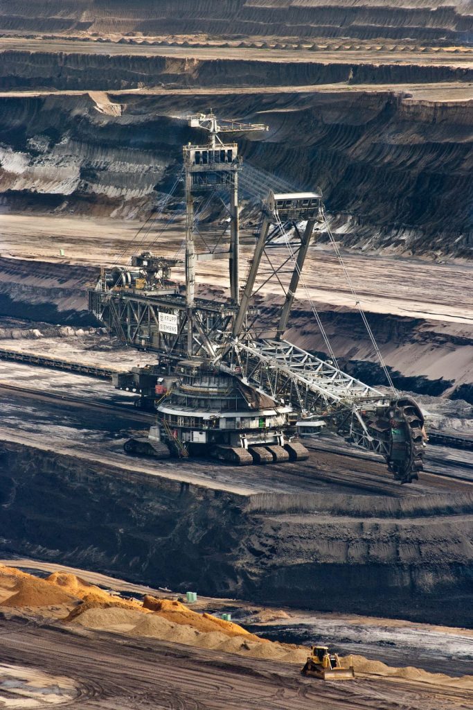
Planning and design: GIS can be used to plan and design new mining operations, including the location and layout of infrastructure, such as roads, buildings, and facilities. This can help to optimize the use of resources and improve efficiency.
Data analysis: GIS can be used to analyze complex data sets, such as geological data, to identify trends and patterns that can inform decision making. This can help to optimize operations and improve efficiency.
Supply Chain Optimization: Explore how GIS supports supply chain optimization in the mining industry. By analyzing spatial data related to transportation networks, logistics routes, and inventory management, mining companies can optimize supply chain operations, minimize transportation costs, and ensure timely delivery of resources to processing facilities
Remote Sensing and Monitoring Technologies: Introduce remote sensing and monitoring technologies complementary to GIS, such as drones and satellite imagery. These technologies provide real-time monitoring of mining operations, enabling early detection of environmental impacts, compliance monitoring, and efficient resource management.
Geospatial Data Integration: Emphasize the importance of integrating diverse geospatial datasets in GIS for comprehensive analysis and decision-making. By integrating geological, environmental, and socio-economic data layers, mining companies can gain deeper insights into the complex interactions between mining activities and the surrounding environment, facilitating sustainable resource management practices.
Mining EXAMPLES
- Exploration: GIS can be used to analyze Landsat 8 data to identify areas of mineralization and potential new mining sites. This can be done by analyzing the spectral reflectance of different minerals, which can be used to create mineral maps that highlight areas of interest.
- Environmental Impact Assessment: GIS can be used to analyze Landsat 8 data to identify areas of land use change and to assess the impact of mining activities on the surrounding environment. This can include analyzing changes in vegetation cover, land use, and land cover.
- Surface and subsurface mapping: GIS can be used to analyze Landsat 8 data to create detailed maps of the surface and subsurface geology of an area, which can be used to identify areas of mineralization, to plan mining operations and to estimate the mineral resources.
- Mine Planning and Reclamation: GIS can be used to create detailed maps of the existing infrastructure, including roads, buildings and other facilities, which can be used to plan mining operations and to design reclamation plans.
- Monitoring and Compliance: GIS can be used to analyze Landsat 8 data to monitor mining operations and to ensure compliance with regulations and environmental standards. This can include monitoring changes in land cover, vegetation, and land use, as well as monitoring the production of tailings and waste rock.
- Water management: GIS can be used to analyze Landsat 8 data to identify areas of water bodies, to monitor the quality of water and to design and implement water management plans.
A real-life example of using GIS and Landsat 8 in the mining industry is the use of these technologies by mining companies in Canada to identify new mining sites and to assess the environmental impact of mining activities. These technologies have also been used in mining industry in Australia, Chile, and South Africa.
- Metallic minerals: Landsat 8 data can be used to identify metallic minerals such as iron, copper, gold, and silver. This is typically done by analyzing the spectral reflectance of different minerals, which can be used to create mineral maps that highlight areas of interest.
- Non-metallic minerals: Landsat 8 data can also be used to identify non-metallic minerals such as clays, sand, and gravel. This can be done by analyzing the spectral reflectance of different minerals and by creating mineral maps that highlight areas of interest.
- Coal: Landsat 8 data can be used to identify coal deposits by analyzing the spectral reflectance of coal, which can be used to create mineral maps that highlight areas of interest.
- Normalized Difference Vegetation Index (NDVI): This index is used to identify areas of vegetation cover, which can be used to identify areas of mineralization.
- Normalized Difference Water Index (NDWI): This index is used to identify areas of water, which can be used to identify areas of mineralization and to design and implement water management plans.
- Tasseled Cap Transformation: This index is used to identify areas of land use change and to assess the impact of mining activities on the surrounding environment.
- Iron oxide ratio index (Fe/Ti), This index is used to identify iron mineralization, which can be used to identify iron ore deposits.
- Enhanced Vegetation Index (EVI): This index is used to identify areas of vegetation cover, which can be used to identify areas of mineralization and to assess the impact of mining activities on the surrounding environment.
- Principal Component Analysis (PCA) and Minimum Noise Fraction (MNF): These indexes are used to extract mineral information from the Landsat 8 data, these indexes are used to identify minerals based on their spectral properties, and to create mineral maps that highlight areas of interest.