How Accurate Location Data Reduces Risk and Saves Money
Transform your solar projects with precision digital twin technology. Collect highly accurate location information to save money, track assets, and optimize performance across your entire solar portfolio.


Why Solar Digital Twins Matter
Precision location data transforms how you plan, build, and maintain solar installations. Here's how our technology saves you money and reduces project risks.
Save up to 30% on operations and maintenance costs through precise asset tracking and predictive maintenance.
Reduce project risks with accurate location data, preventing costly errors and delays during installation.
Maximize energy output with precise positioning data and real-time monitoring capabilities.
Track every component with centimeter-level accuracy for better inventory and maintenance planning.
Advanced Digital Twin Capabilities
High-Precision Mapping
Centimeter-level accuracy for every solar panel and inverter location
Real-Time Monitoring
Live tracking of asset performance and environmental conditions
3D Visualization
Interactive 3D models for better planning and maintenance
Predictive Analytics
AI-powered insights for maintenance scheduling and optimization
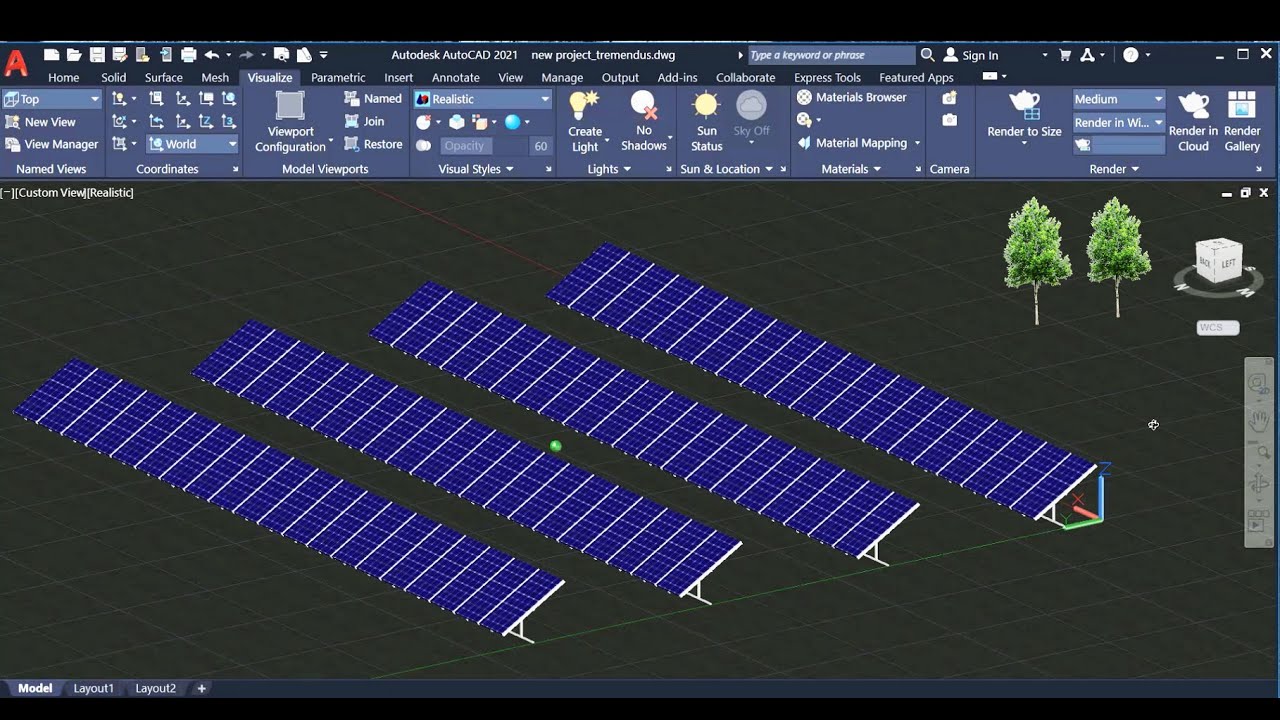
Solar Digital Twin Applications
From utility-scale farms to innovative solar infrastructure, our digital twin technology adapts to every project type.
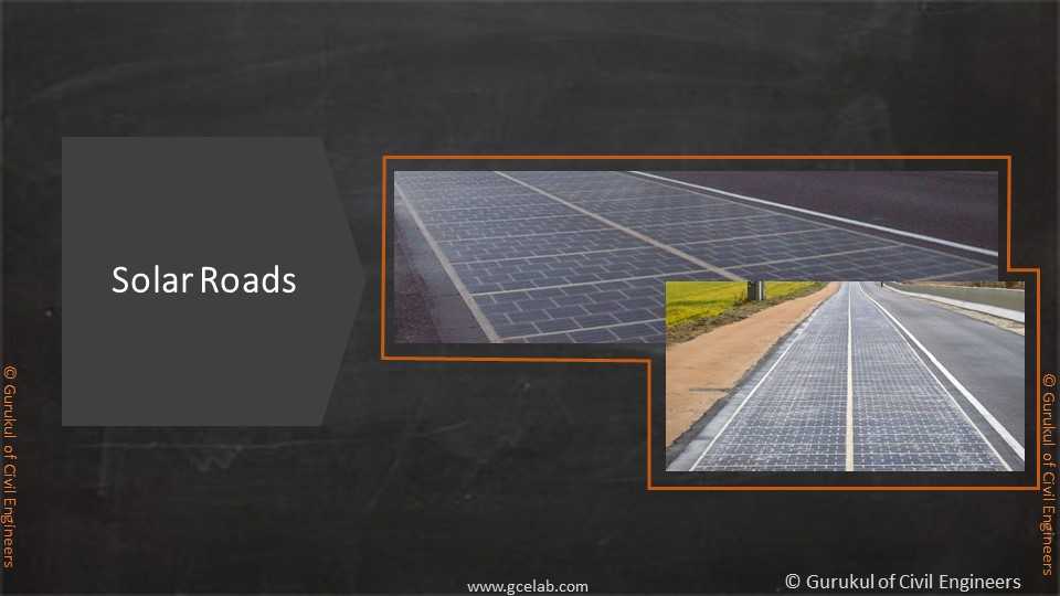
Solar Roads
Next-generation infrastructure mapping
Precision mapping for solar road installations, integrating renewable energy generation with transportation infrastructure.
- Traffic pattern analysis
- Load capacity mapping
- Environmental impact assessment
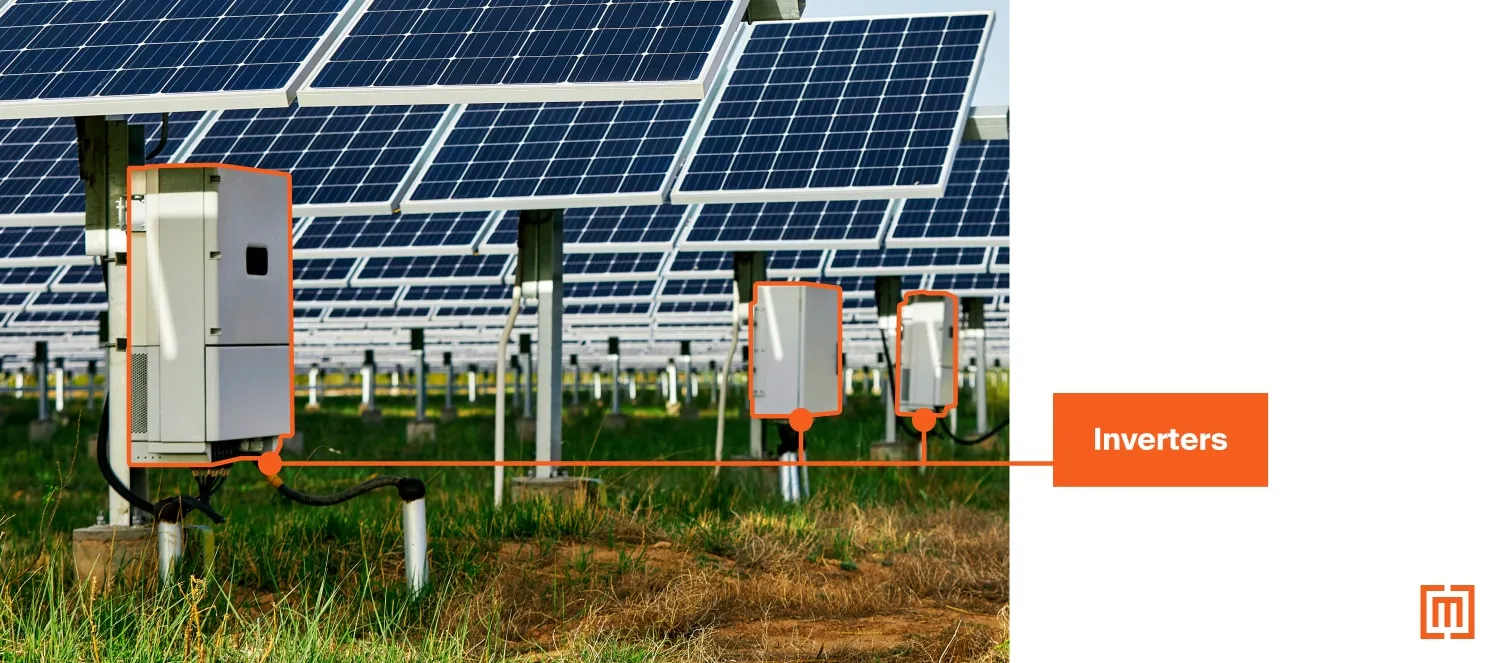
Asset Tracking
Comprehensive component monitoring
Track every inverter, panel, and component with centimeter-level accuracy for optimal maintenance and performance.
- Real-time performance monitoring
- Predictive maintenance alerts
- Inventory management
Ready to Transform Your Solar Projects?
Join industry leaders who are already saving millions with precision digital twin technology. Schedule a personalized demo and discover your potential ROI.
✓ 30-minute personalized consultation ✓ ROI assessment ✓ Implementation roadmap
Technologies We Work With
Leveraging cutting-edge technologies and industry-leading tools to deliver exceptional geospatial solutions and data analytics services.
QGIS
GIS Software
ESRI ArcGIS
GIS Platform
PostgreSQL
Database
PostGIS
Spatial Database
AWS
Cloud Platform
Google Cloud
Cloud Platform
DuckDB
Analytics Database
OpenAI
AI Platform
Claude AI
AI Assistant
CVAT
Annotation Tool
Python
Programming
React
Frontend
Node.js
Backend
Docker
Containerization
Kubernetes
Orchestration
Azure
Cloud Platform
TensorFlow
Machine Learning
Pandas
Data Analysis
NumPy
Scientific Computing
Jupyter
Data Science
Git
Version Control
Linux
Operating System
Ubuntu
Operating System
Mapbox
Mapping Platform
Leaflet
Web Mapping
Fastapi
API Framework
GeoPandas
Geospatial Analysis
GDAL
Geospatial Library